
Inspections
Our thermal imaging can pinpoint issues that are not detectable to the human eye. Drone inspections are a cost effective and a much safer alternative to traditional methods. Our most common inspections projects include:
-
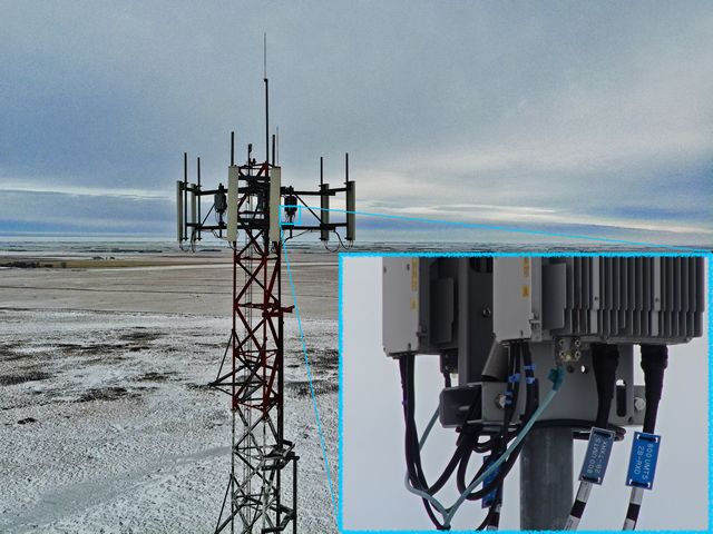
Communication Tower Inspections
Aerial inspections give a full 360° view of the entire structure that can be saved and reviewed by anyone at anytime. Drone inspections will often reveal issues that would not be caught in a traditional inspection there is no risk of a person being injured or falling.
-
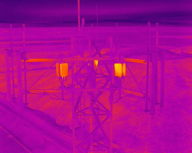
Thermal Inspections
Thermal imaging allows you to save time and money by identifying areas of concern which cannot be seen by the naked eye. Scanning structures, buildings or solar panels from the air will help identify areas of heat loss or damage. Some of the more common applications of our thermal sensors include search and rescue, hot spot locations, solar panel assessments, gas leaks and building heat loss.
-
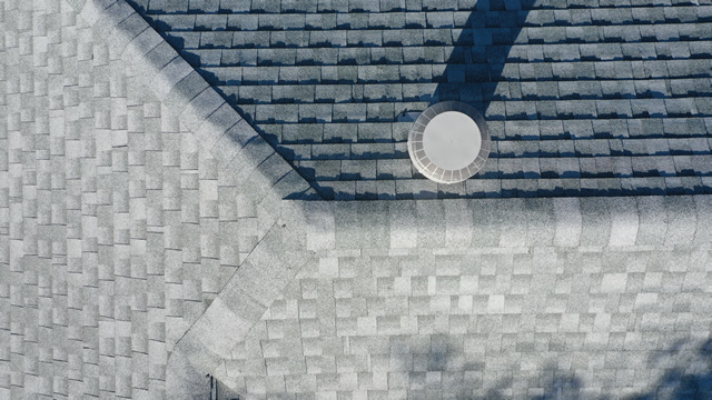
Roof Inspections
Using drones are much faster and safer way of conducting roof inspections. We can build a detailed 3D model of the roof and our thermal sensors can help detect areas of heat loss or overheating of expensive equipment such as fans or AC units.
-
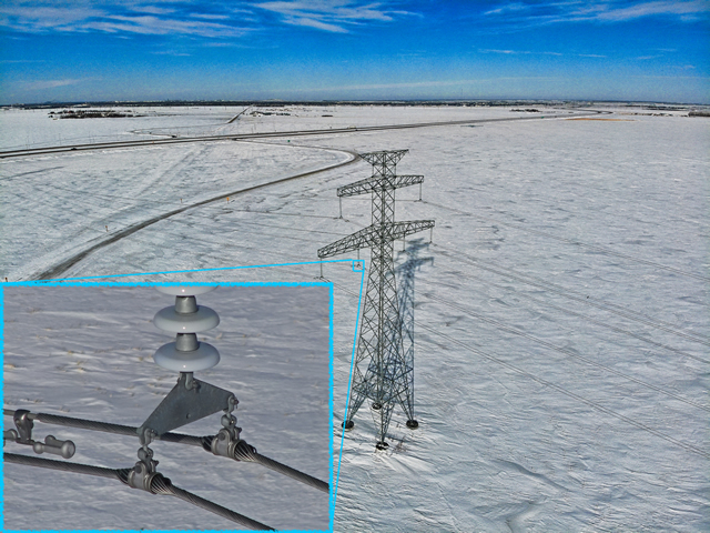
Power Line Inspections
Using drones for power line inspections keep people out of harm's way. Our powerful zoom lenses and thermal sensors are able to capture the smallest of details to give an overview and evaluation of the condition or the lines and poles. It reduces downtime and helps with preventative maintenance planning.
Photogrammetry, Mapping and 3D Models
Our cost effective use of UAV technology allows us to fly your site without interfering with or stopping any active operations. We provide highly accurate and detailed orthomosaics which can be used to measure distances with centimetre level accuracy. Our 3D models provide a unique perspective to any site and allow us to conduct volumetric surveys for aggregate stockpile reporting. The most common uses are:
-
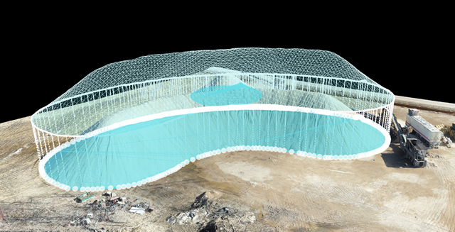
Volumetric Surveys
We can measure your stockpiles as many times throughout the year as you'd like so you know exactly how much material is entering or leaving your site.
-
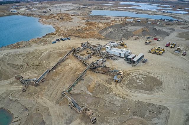
Construction/Inspections
We can fly the area before and after construction to help determine both the total acreage disturbance and the total volumetric of material excavated and placed. We can fly the area during construction to provide progress reports as often as you need.
-
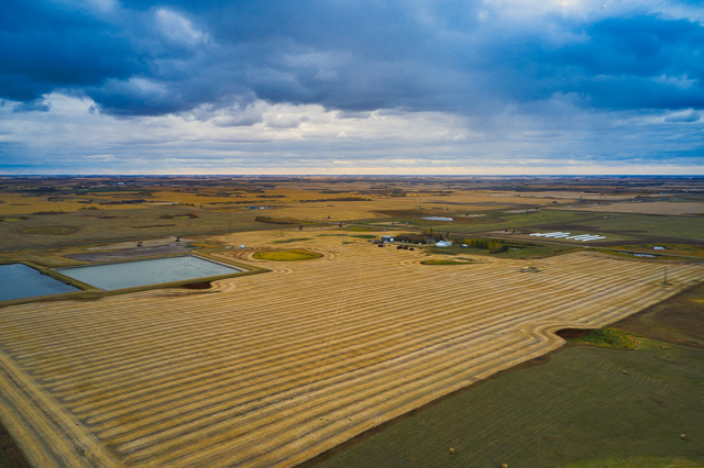
Acreage calculations
We can quickly and easily measure the size of any parcel of land. Whether you need to know how many cultivated acres you have or how much of an area is affected by elements such as flooding, hail or fire, we can provide you with a detailed map with all the information you need.
Photography/Videography Capture & Editing
We offer a wide variety of photography and videography services to meet the needs of any project. We can look after all of the photo, video and audio editing for you, or if you would prefer to do it yourself, we can provide you with all of the digital files from the shoot. Some of our most popular projects include real estate marketing, aerial farm photos, action sports, weddings, sporting events and many more...
Training
We offer custom training programs to fit the needs of any client. Whether you're an individual looking to get your basic drone pilot's license or a company looking to train multiple people as advanced, our Transport Canada certified flight reviewer's can help. In addition to pilot training, we offer flight training on some of the most common consumer and industrial drones.